|
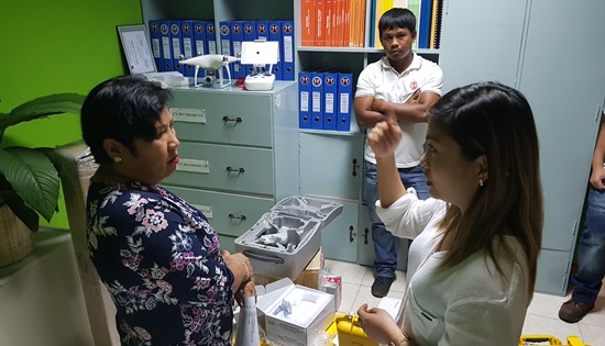
Engr.
Rosario B. Rosete (left), Chief of Planning and Design
Section inspects the surveying equipments worth P3M which
includes Real-time kinematic (RTK) satellite navigation and
state-of-the-art drone on July 9, 2018 at the Planning and
Design Section. |
DPWH-Biliran DEO
now equipped with enhanced survey use equipments
Press Release
August 2, 2018
NAVAL, Biliran –
The Department of Public Works and Highways (DPWH) Biliran District
Engineering Office (BDEO) is now advancing its planning processes
through the use of the newly acquired surveying equipments.
David P. Adongay Jr.,
District Engineer said that BDEO has recently procured P3M worth of
Real-Time Kinematic (RTK) satellite navigation and a state of the
art drone that will help surveyors upgrade its planning and
surveying methods.
RTK positioning satellite
navigation is a technique used to enhance the precision of position
data derived from satellite-based positioning systems such as GPS,
among others.
“The procurement of RTK
and Drone will keep Biliran in league with its counterpart district
offices which have already state of the art surveying instruments,”
said Adongay.
Engr. Rosario B. Rosete,
Planning and Design Chief said that BDEO is previously using the
traditional total station instrument to measure angles in both the
horizontal and vertical planes.
“The use of the latest
model of RTK will lessen the tediousness in the preparation of plans
in as much as the data gathered using RTK can automatically show the
profile, traverse, contours and cross section of the project
surveyed,” Rosete said.