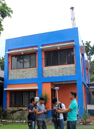
DPWH upgrades
survey equipment system
By
DPWH 2nd LED
March 22, 2019
CARIGARA, Leyte –
Meant to provide more accurate and reliable data, the Department of
Public Works and Highways (DPWH) Leyte Second District Engineering
Office upgraded its Real Time Kinematic (RTK) equipment, from
3-kilometer straight-line radius coverage to 70 kilometers.
 RTK is a satellite
navigation system that is used for measurement and survey of land
areas. It enhances the accuracy of position data derived from
satellite-based positioning technologies and uses measurements of
the phase of the signal's carrier wave.
RTK is a satellite
navigation system that is used for measurement and survey of land
areas. It enhances the accuracy of position data derived from
satellite-based positioning technologies and uses measurements of
the phase of the signal's carrier wave.
The new survey system will
now reach the 14 municipalities of the second district of Leyte,
namely, Barugo, Burauen, Capoocan, Carigara, Dagami, Dulag, Jaro,
Julita, La Paz, Mac Arthur, Mayorga, Pastrana, Tabontabon and Tunga.
The device relies on a
single reference station or interpolated virtual station to provide
real-time corrections, providing up to centimeter-level accuracy.
According to Joshua
Navarro, the Technical Support of the Georight Matics Incorporated (GMI),
this tool is linked with National Mapping and Resource Information
Authority (NAMRIA), the central mapping agency of the Philippines,
to ensure precision of the data.
He added that instead of
radio device, the system could now easily be accessed 24/7 through
internet or mobile data.
“The use of this device is
just timely since the district office aims to fast-track numerous
infrastructure projects under the “Build, Build, Build” program of
the government,” District Engineer Gerald Pacanan said.
The upgraded system will
help the Planning and Design Section to speed up the production of
program or works and plans for the projects of the district
engineering office.